Agendra Kumar
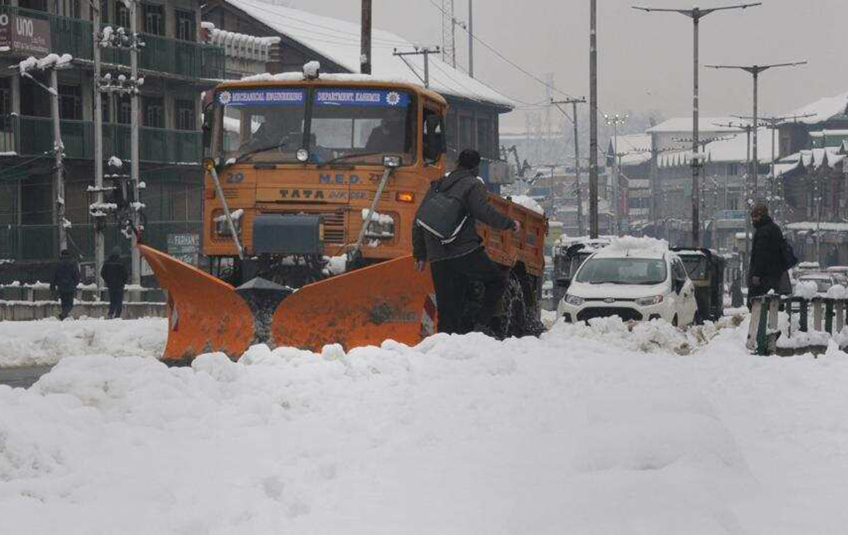
In a recent turn of events, the Jammu & Kashmir Government was reported to be mulling over declaring the November 7th, 2019 snowfall as ‘natural calamity’ in the valley. Leaving a trail of death and destruction, the calamity claimed at least 7 human lives. Yet another element that took a major hit due to the snowfall in the valley was Horticulture. A complete loss assessment of the sector was commissioned in order to be able to claim adequate relief for the farmers who suffered losses due to the snowfall. Likewise, snow becomes a major hurdle for commuters across high altitude states, which receives snow fall. This,kind of snowfall every year leads to a complete blockade for the states/cities during the winter season.
Despite all planning and preparations,the citizen send up to dealing with the winter wrath, because of the unpredictability of the nature of snow and ice events. This uncertainty makes it difficult to track costs, measure resource requirement and monitor the resource distribution throughout the city. With these issues daunting a country like India, which is typically not a cold country, the question is, is there room for prediction of snow? It has various socio-economic and environmental implications such as winter tourism, transport, environment, land management, water and many other developmental activities.
Fighting back natural calamities with technology: The answer lies in the moderntechnologies like Geographic Information System (GIS) that powers tools with Geospatial technology to helpprofessionals work smarter.Not only has weather prediction evolved considerably over the years, giving affected areas more advance warning, but predictive analytics and other advances in GIS technology are helping governments, communities and businesses prepare to respond in real-time as needs arise.
By leveraging GIS agenciescan
* Have a better preparednessfor snowfall with live, constant weather data
* Use analytical tools to model spatial distributions of data for efficient routingand ensure continuity of life critical services
* Enable a comprehensive dashboard with live plow and progress monitoring
* Understanding the terrain and snowfall data to identify avalanche prone-areas
* Identify areas to issue alerts to minimize economic and life loss and support quick response
* Even businesses can combine this data to understand the risk to their supply chains
This system can seamlessly integrate virtuallyanything which has a spatial component in it.
EWeb maps can be published that illustrate what’s happening and what could happen. Citizens can share information which can be placed on maps quickly and connect with almost any kind of data – it’s called real-time GIS.
Given these benefits, a number of professionals working in natural disaster management departments are resorting to GIS technology to improve their services and increasing efficiency of operations. Not only does this technology helps in better predictions, but also offers intelligent maps, accurate weather data and spatial analytics. Integration of this technology would also entail upskilling of existing workforce to create an efficient and powerful management center. In addition to improved snow and ice control planning, GIS also aids in increased internal and external communications, along with better cost management.
With live and constant weather data,GIS enables the departments to stay ahead of storms. It helps in better preparation for the snowfall headed towards a city or town. This information helps in accurate resource allocation that in turn helps to keep the city moving and saving a lot of time &money. Further enhancing the winter and snow management, GIS also enables use of analytical tools to design spatial distribution of data and look for patterns to determine the most efficient routes for snowplows.
GIS use-cases across the globe: To be prepared for the snow season,nations across the globe are resorting to GIStechnology. Integrating GIS into their snow and ice control plans has enabled them to plan effective response; execute operations and share intelligent, actionable data and information to various departments.Snow and Avalanche Study Establishment (SASE) has developed a GIS based application software of Snow Information System (SIS) for spatial visualization and analysis of snow and meteorological conditions around the Kashmir valley in Jammu & Kashmir state. Similarly, the city of Poland uses web maps to organize and prioritize streets, so that in the event of a snow storm, the workers know exactly where to start from, in order to keep the traffic moving. Likewise, the city of Minneapolis uses this technology to display snow removal status.
Conclusion: The use of Geospatial technology to manage snow and ice is not new, however, earlier it was only limited to known avalanche areas. Nonetheless GIS, with advancements like improved data resolution; sophisticated remote sensing and satellite technology combined with improved computer literate researchers and practitioners, offers a promising future for better snow and winter management.
(The author is President, ESRI India)
Trending Now
E-Paper


