Excelsior Correspondent
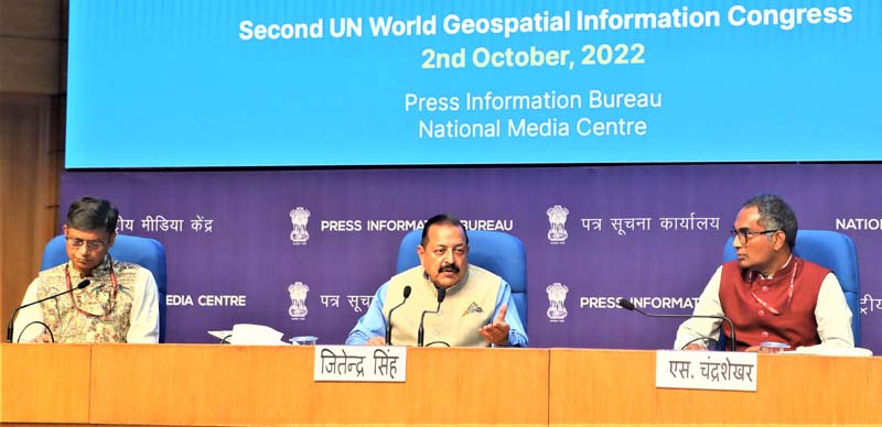
NEW DELHI, Oct 2 : Briefing the media about the upcoming Second United Nations World Geospatial Information Congress (UNWGIC) scheduled at Hyderabad from October 10-14,Union Minister of State (Independent Charge) Ministry of Science and Technology; Minister of State (Independent Charge) Ministry of Earth Science; MoS PMO, Personnel, Public Grievances, Pensions, Space and Atomic Energy, Dr Jitendra Singh today said that India’s geospatial economy is expected to cross Rs 63,100 crore by 2025 at a growth rate of 12.8%.
He said, geospatial technology has become one of the key enablers in socio-economic development by enhancing productivity, ensuring sustainable infrastructure planning, effective administration, and aiding the farm sector.
Dr Jitendra Singh said, with the freedom to collect, generate, disseminate, publish, and digitize geo-information, the Indian Geospatial Economy is expected to reach Rs 63,100 crore in 2025 at a growth rate of 12.8%. He said, the Modi Government is consistently playing an enabler’s role in expanding the scope of geospatial applications in multiple spheres to benefit every section of the society in India.
Dr Singh said, the Second UNWGIC assumes significance as it is in sync with the Digital India initiative of the Government of India to empower society digitally. He added that the Government’s plan envisages the facilitation of location-based/GIS-based decision-making for planning, e-Governance, and better utilization of resources available.
The conference will be attended by over 2000 delegates including 700 plus international delegates & participants from about 120 countries. Moreover, National Mapping Agencies (NMAs) like the Survey of India, which has a glorious history of 255 years, senior officials, non-governmental organizations, academia, and industry, user, & private sector from across the globe will take part in the Geospatial Congress.
Dr Jitendra Singh said, in the last eight years, India has been striving toward developing fundamental and essential infrastructure and facilities for citizens. He said, under the New India Vision of Prime Minister Modi, the Government addresses core issues like water, health, education, sanitation, housing, and infrastructure for all. Leveraging the power of geospatial information and technologies will help the country address its multi-dimensional financial growth goals and sustainable development faster, the Minister added.
Dr Jitendra Singh emphasised that Geospatial technology and Geographic Information System (GIS) is going to make a significant impact in the way India has been adopting this technology and moving ahead. He said, the world is looking at India as to how it is using technology to tackle some of the major humanitarian and sustainability problems.
Highlighting the role and scope of geospatial, Dr Jitendra Singh said, “Accurate, real-time geospatial information combined with other data, like demography, healthcare facilities, and vaccination centres, has immensely helped us to tackle the COVID-19 pandemic emergency effectively.” He added that the Government has been digitizing and mapping the entire rural sector to ensure better planning and implementation of the developmental schemes.
In his statement, Secretary, DST, S. Chandrasekhar said, the Government of India is committed to advancing the critical role of integrated geospatial information management in implementing national and global development objectives for a shared future and a more inclusive world.
He said, India is steadfast in working together to strengthen geospatial infrastructure at local, national, regional, and global levels and harness the potential of geospatial knowledge services by developing innovative, effective, and scalable solutions to address sustainable development goals (SDGs).
Convened by the United Nations Committee of Experts on Global Geospatial Information Management (UN-GGIM), the Second UNWGIC 2022 will be organized by the Department of Economic and Social Affairs of the United Nations and hosted by the Department of Science & Technology – Ministry of Science and Technology, Government of India.

