Zafri Mudasser Nofil
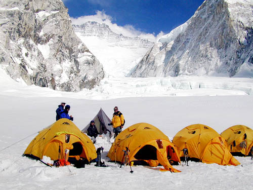
At 8,848 metres (29,028 feet) above sea level, Mount Everest is the world’s tallest peak. And now in an unprecedented step, the height of Mount Everest is set to be “re-measured” by the Survey of India to determine whether it has really shrunk following a devastating earthquake in Nepal two years ago as claimed by scientists.
An expedition from the Survey of India would depart in two months for Nepal to conduct the exercise that comes in the backdrop of doubts expressed by a section of the scientific community about the shrinking of the Everest.
The deadly 7.8-magnitude earthquake in Nepal in 2015 killed thousands of people and altered the landscape across the Himalayan nation.
After the quake, satellite images were used to support emergency aid organisations, while geoscientists used satellite measurements to analyse its effects on the land.
Radar imagery from Sentinel-1A satellite showed that the maximum land deformation is only 17 km from Kathmandu, which explains the extremely high damage experienced in this area, according to the European Space Agency.
“By combining Sentinel-1A imagery acquired before and after the quake, changes on the ground that occurred between the two acquisition dates lead to rainbow-coloured interference patterns in the combined image, known as an ‘interferogram’, enabling scientists to quantify the ground movement.
“Sentinel-1A’s swath width of 250 km over land surfaces has allowed for an unprecedented area size to be analysed from a single scan. The entire area will be covered under the same geometry every 12 days, allowing for the wider region to be regularly monitored and fully analysed for land deformation with the powerful ‘interferometry’ technique,” it said.Sentinel-1A is the first satellite for the Copernicus environment-monitoring programme led by the European Commission. Its all-weather, dayor-night radar imagery is particularly suited to support impact assessment for many types of geohazards. The satellite is planned to provide systematic observations of tectonic and volcanic areas at global level.
Imagery from the Sentinels and other Copernicus contributing missions are coordinated by ESA to be used by the Copernicus Emergency Management Service (EMS), which supports all phases of the emergency management cycle.
The Copernicus EMS was activated on the day the earthquake struck on April 25, 2015, prompting ESA to begin collecting satellite imagery, which is being made available to support relief efforts.
The Survey of India’s project, for which required sanctions have been obtained, would help the future scientific studies as well, according to Surveyor General of India Swarna Subba Rao.
“We are sending an expedition to Mount Everest. Everest’s height was declared, if I remember correctly, in 1855. Many others also measured it. But the height given by Survey of India, even today, is taken as the correct height. It is 29,028 ft,” he said.
“We are re-measuring it. It is almost two years since the major Nepal earthquake. After that, there is a doubt in the scientific community that it is shrinking. That is one of the reasons. Second reason is, it helps in scientific studies, plate movements etc,” he said.
The endeavour would take about a month for observation and another 15 days for computation and declaration of data.
According to Rao, the height of Mount Everest is planned to be measured this time by two methods- – using Global Positioning System (GPS) and a ground method.
“There are two methods. One is GPS. It is a survey instrument. It looks like a transistor. If you put it on the summit, say for 10 minutes, it tells you the height. That is one.
“The Second is, ground method. Triangulation. We observe. The height can be calculated from ground,” he added. The measurement is being done by the two methods for better confirmation of the findings.
According to Science portal Live Science, the tallest mountain in the world also got a wee bit shorter.
“The radar images reveal that some of the world’s tallest peaks – including Mount Everest – dropped by about 1 inch (2.5 cm), according to the nonprofit UNAVCO, a geoscience research consortium. That’s because the Earth’s crust relaxed in the areas north of the Kathmandu, after the earthquake released pent-up strain.
“Still, on the whole, the Himalayas continue to grow to stupendous heights, studies show. Some parts of the Himalayas are rising about 0.4 inches (1 cm) every year, due to the ongoing collision between the Indian and Eurasian tectonic plates,” it said.
According to Encyclopaedia Britannica, “Controversy over the exact elevation of the summit developed because of variations in snow level, gravity deviation, and light refraction. The figure 29,028 feet (8,848 metres), plus or minus a fraction, was established by the Survey of India between 1952 and 1954 and became widely accepted. This value was used by most researchers, mapping agencies, and publishers until 1999.
“Attempts were subsequently made to remeasure the mountain’s height. A Chinese survey in 1975 obtained the figure of 29,029.24 feet (8,848.11 metres), and an Italian survey, using satellite surveying techniques, obtained a value of 29,108 feet (8,872 metres) in 1987, but questions arose about the methods used. In 1992 another Italian survey, using the Global Positioning System (GPS) and laser measurement technology, yielded the figure 29,023 feet (8,846 metres) by subtracting from the measured height 6.5 feet (2 metres) of ice and snow on the summit, but the methodology used was again called into question.
“In 1999 an American survey, sponsored by the (US) National Geographic Society and others, took precise measurements using GPS equipment. Their finding of 29,035 feet (8,850 metres), plus or minus 6.5 feet (2 metres), was accepted by the society and by various specialists in the fields of geodesy and cartography.
The Chinese mounted another expedition in 2005 that utilized ice-penetrating radar in conjunction with GPS equipment. The result of this was what the Chinese called a ‘rock height’ of 29,017.12 feet (8,844.43 metres), which, though widely reported in the media, was recognised only by China for the next several years. Nepal in particular disputed the Chinese figure, preferring what was termed the ‘snow height’ of 29,028 feet.
In April 2010 China and Nepal agreed to recognize the validity of both figures.”