Excelsior Correspondent
NEW DELHI, July 27: Union Minister Dr Jitendra Singh today presented National Science Awards and lauded India’s “Deep Sea” initiatives.
He also complimented the scientists for conducting world’s first locomotion trials of the Deep-Sea Mining System in the Central Indian Ocean at depth of 5270 meters.
Speaking as Chief Guest on the 16th Foundation Day of the Ministry of Earth Sciences (MoES), Dr Jitendra Singh said, this is the maximum depth at which such a machine was successfully tested anywhere in the world.
Dr Jitendra Singh said, the mineral wealth which is hidden in the sea, the thermal energy which is in the sea water, can give new heights to the development of the country. The Minister said, the R&D and Exploration activities in the Amrit Kaal of next 25 years will be an important hallmark of India’s economy when it turns 100.
Dr. Jitendra Singh called upon the MoES family of professionals, to promote and discover a new perspective of acquiring advanced knowledge and dedicate themselves towards making the Ministry as one of the best in the world in providing services on weather, climate, ocean, and seismology and bringing in more socio-economic benefits to the country.
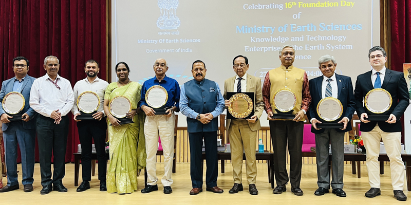
Dr Jitendra Singh gave away Eight National Awards 2022 including Lifetime Excellence Award, Lady Scientist Award, 2 Young Researcher Award and one each in Geo, Polar, Atmospheric and Ocean Sciences.
He also launched a first-of-its-kind and state-of-art fully automated buoy-based coastal observation and water quality nowcasting system for the Indian Ocean developed by Indian National Centre for Ocean Information Services (INCOIS), Hyderabad. The system includes high-end sensors onboard an automated buoy integrated to a coastal observatory located in Kochi. The system will benefit various stakeholders, including coastal dwellers, fisherfolk, maritime industry, researchers and agencies dealing with pollution, tourism, fisheries, and the coastal environment.
Dr Jitendra Singh also released a special issue of the popular Indian journal-magazine Geography and You (GnY), themed ‘India’s fragile coast’. The issue highlights some of the views, research, work, and vision of the scientists of the National Centre for Coastal Research (NCCR), Chennai towards developing and improving India’s capabilities in addressing societal, economic, and environmental challenges of the country’s coastal zone.
Dr Jitendra Singh also unveiled a unique compendium of the monthly seismological bulletins (2011-2020) published by the National Centre for Seismology (NCS), New Delhi. The compendium provides earthquake monitoring data for more than 8,400 earthquakes in India and its neighboring regions in the past decade.
Another important publication released by Dr Jitendra Singh entitled ‘Climatological Tables of Observatories in India 1991-2020’ would benefit a variety of stakeholders from sectors such as climatology, agriculture, geography, hydrology, biology, economics, ecology, and environment. The publication provides average values of climate elements such as temperature, rainfall, relative humidity, winds, clouds, visibility, extreme values of temperature and rainfall, and frequency of occurrence of weather phenomena from all meteorological observatories in India.
Presenting a future blueprint for the Ministry, Dr Jitendra Singh informed that in the next two years, MoES has ambitious plans of development of a manned submersible to carry 3 scientists to a depth of 6000 metres in the ocean with suit of scientific sensors and tools; development of an Integrated Mining System for mining Polymetallic Nodules from 6000 m depth; Increase the number of Doppler Weather Radars from the current number of 34 to about 50; Integrated meteorological services for the north-eastern region; Augment the existing High Performance Computing System from 10 PFlops to about 27 PFLops and Improve the horizontal resolution of the weather forecast model from existing 12 km to 6 km to help farmers in obtaining block level forecasts.

