
WD to hit J&K; rain, snowfall likely in 48 hrs
Gopal Sharma / Suhail Bhat
JAMMU/ SRINAGAR, Jan 30: While the night temperature has started rising in Kashmir and many parts of Jammu, the Chilla-i-Kalan ended in Kashmir today, whereas, the MeT office has predicted light to moderate rain with gusty winds at many places and snowfall in the higher reaches in Jammu and Kashmir during next two days.
Follow the Daily Excelsior channel on WhatsApp
An official from Meteorological Department said that on January 31 and February Ist, the weather in J&K will remain generally cloudy, with light to moderate rain, and thunder-storm/gusty winds at many places, and snowfall in the higher reaches.
Click here to watch video
He further said that on February 2 and 3, the weather will again remain generally cloudy, with light rain and snowfall at scattered to many places, in the Jammu and Kashmir region. However, from February 4 to 6, it will remain partly cloudy across the region.
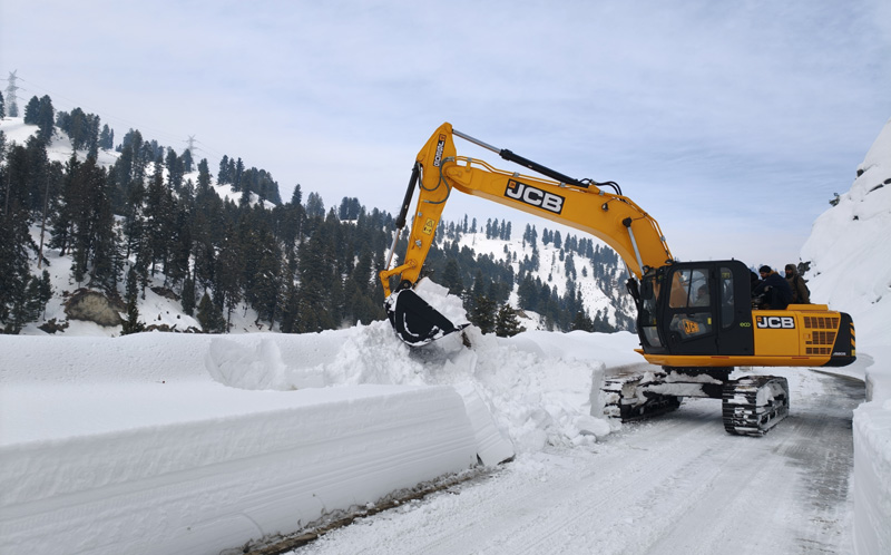
While issuing advisory, the weatherman said that travelers and transporters are advised to confirm road/ highway status from the respective Traffic Control Units (TCUs) and follow advisory. The farmers have been advised to suspend farming operations during next seven days. The people in the snow bound areas are further advised not to venture in sloppy and avalanche prone areas.
Meanwhile, the 40-day Chilla-i-Kalan, the harshest phase of winter in Kashmir, ended today as minimum temperatures showed a gradual rise across the Valley, bringing slight relief after weeks of persistent subzero nights.
Chilla-i- Kalan, which began on Dec 21, is characterized by intense cold, frequent freezing temperatures and a higher probability of snowfall. Although the period formally ends on Jan 30, Meteorologists said cold conditions will continue. It will be followed by Chilla-i-Khurd, a 20-day phase of comparatively milder cold, and Chilla-i-Bacha, a 10-day spell that signals a gradual transition toward spring.
The MeT office said that in the summer capital, the minimum temperature settled at minus 1.3 degrees Celsius overnight, compared with minus 0.6 degrees the previous night. It was 2.2 degrees above the seasonal normal. The MeT said intermittent cloud cover and light winds helped prevent a sharper drop in temperatures despite clear skies during parts of the night.
In south Kashmir, Konibal recorded a minimum temperature of 1.0 degree Celsius, Pulwama 0.1 degree Celsius, and Kulgam 1.1 degree Celsius, remaining above the freezing point. Most weather stations recorded minimum temperatures above the seasonal average.
Sonamarg in Ganderbal district was the coldest recorded place in Jammu and Kashmir at minus 10.6 degrees Celsius, slightly higher than the previous night’s minus 11.2 degrees. The ski resort of Gulmarg in Baramulla district recorded a low of minus 7.6 degrees, while Pahalgam in south Kashmir recorded minus 5.5 degrees.
In Qazigund, the minimum temperature settled at minus 0.3 degrees Celsius. Kokernag recorded minus 2.5 degrees, while Kupwara recorded minus 3.1 degrees Celsius, according to the department. No rainfall or snowfall was reported across the Valley during the past 24 hours.
Winter capital Jammu and many other places in the region today recorded a further rise in day and night temperatures. Jammu experienced a maximum temperature of 22.1 degrees Celsius, and minimum 9.3 deg C; Katra township a day temperature of 20 deg C and night 8.4 deg; Banihal town minimum 1.1 deg and Batote a night temperature of 3.2 degrees C on Friday.
Bhaderwah town of Jammu region recorded a night temperature of minus 1 degrees C and day temperature of 15.0 deg C today. Udhampur recorded a minimum temperature of 3.0 deg C; Kishtwar a night temperature of 3.1 deg C; Doda town 5.3 deg, Rajouri 4.5, Ramban 5.8 deg C and Kathua a night temperature of 7.4 degrees C on Friday.
The Weatherman has indicated that another spell of western disturbances will hit J&K from tomorrow evening, resulting in wet weather and snowfall in the higher reaches.